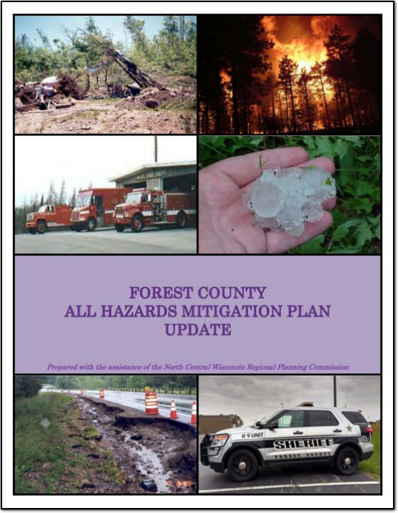
Forest County All Hazards Mitigation Plan Update 2021

Part I of the Forest County All Hazards Mitigation Plan (AHMP) Update describes and documents the process used to develop the Plan Update. This includes how it was prepared and who (committee, organizations, departments, staff, consultants, etc.) was involved in the update process. It also describes the local governments involvement, the time period in which the update was prepared, and who to contact to answer questions and make recommendations for future amendments to the Plan.
Merrill Safe Routes To School

Safe Routes to School (SRTS) programs are an opportunity to make walking and bicycling to school safer for children in grades K-8, and to increase the number of children who choose to walk and bicycle. On a broader level, SRTS programs can enhance children’s health and well-being, ease traffic congestion near the school, and improve community members’ overall quality of life.

In 2016, 10 school districts won a WisDOT SRTS planning grant as part of the North Central Wisconsin Regional SRTS Program, administered by NCWRPC.

In the fall of 2019-2020, the City of Merrill, and the Merrill School District began SRTS Planning with the assistance of the North Central Wisconsin Regional Planning Commission (NCWRPC). The NCWRPC will guide the Merrill SRTS Task Force through the planning process.

The following schools are part of SRTS planning:

  • Jefferson Elementary School (K-5);
  • Kate Goodrich Elementary School (K-5);
  • Washington Elementary School (K-5);
  • Prairie River Middle School (6-8); and
  • Merrill High School (9-12);

    The Merrill Safe Routes To School (SRTS) Task Force consists of people from the schools, law enforcement, local government officials, and local residents.

Resources
Pedestrian Safety
Bicycle Safety
PSAs

Merrill SRTS Plan
Merrill SRTS Plan (without maps)
Full Adopted Merrill SRTS Plan with all maps & attachments

Prairie River Middle School
Map 3A – Site Assessment
Map 4A – Transportation
Map 5A – School Routes
Map 6A – Recommendations
PRMS SRTS Action Plan

Jefferson Elementary School
Map 3B – Site Assessment
Map 4B – Transportation
Map 5B – School Routes
Map 6B – Recommendations
Jefferson Elementary SRTS Action Plan

Kate Goodrich Elementary School
Map 3C – Site Assessment
Map 4C – Transportation
Map 5C – School Routes
Map 6C – Recommendations
Kate Goodrich Elementary SRTS Action Plan

Washington Elementary School
Map 3D – Site Assessment
Map 4D – Transportation
Map 5D – School Routes
Map 6D – Recommendations
Washington Elementary SRTS Action Plan

Merrill High School
Map 3E – Site Assessment
Map 4E – Transportation
Map 5E – School Routes
Map 6E – Recommendations
Merrill High School SRTS Action Plan

Attachments:
A – Student Tally & Parent Survey forms
B – 2019 Results from Student Tallies & Parent Surveys
C – SRTS Task Force Meetings and Adoption Documentation
D – Bicycle Parking Guidelines
E – Three Factors Increase Walking and Biking–CDC

Make questions or comments about the planning here.
(Email link to submit comments on this plan.)

NCWRPC 2021 Work Program

The NCWRPC prepares and adopts an Annual Work Plan. Every fall the NCWRPC develops its work program for the following year and adopts that plan in January. However, there is always room for more. Feel free to contact us if your community is thinking about a planning related project. Projects may fall under any of our five program areas of economic development, geographic information systems (mapping), intergovernmental cooperation, land use, and transportation. In addition to several on-going regional efforts related to economic development and transportation, staff typically helps with numerous local level projects, including comprehensive plans, outdoor recreation plans, grant applications, and more.

Staff is always available to answer a phone call, respond to an email, or attend a meeting any time during the year. Contact Dennis Lawrence at dlawrence@ncwrpc.org or (715) 849-5510, Extension 304, to discuss a possible project.

Wood County

Wood County is a county located in central Wisconsin. As of the 2020 census, the population was 74,207. The county seat is Wisconsin Rapids. Wood County was created in 1856 and is named after Joseph Wood, who was a Wisconsin State Assemblyman. The county is known for its many lakes, rivers and outdoor recreational opportunities, including the Wood County Parks, the Wisconsin River and the Ice Age Trail. The county is home to the city of Wisconsin Rapids, which is the county’s largest city and the regional center for commerce, industry, healthcare, and education. The county also has several small towns and communities, including Marshfield, Nekoosa, and Port Edwards. The county has a diverse economy, with healthcare, manufacturing and service industries being the main drivers. The county is also known for its paper mills, which have been a staple industry in the area for many years.

TitleDate
Wood County Comprehensive Plan and Housing Study 2024April 23, 2024
Wisconsin Rapids Safe Routes To School – 2024April 3, 2024
Wood County Broadband PlanMarch 8, 2024
Town of Saratoga Comprehensive Plan 2023March 6, 2024
Wood County Economic Profile 2024January 22, 2024
Wood County Bicycle and Pedestrian Plan 2023October 18, 2023
Town of Saratoga Outdoor Recreation Plan 2023-2027March 15, 2023
Town of Seneca Comprehensive Plan 2022May 1, 2022
Town of Sigel Comprehensive Plan 2022February 2, 2022
Wood County Economic Profile 2022January 1, 2022
City of Pittsville Outdoor Recreation Plan 2022-2026November 1, 2021
Nekoosa Safe Routes to School PlanJuly 1, 2020
Wood County Locally Developed, Coordinated Public Transit-Human Service Transportation Plan 2019-2023August 31, 2018
Wood County Locally Developed, Coordinated Public Transit-Human Service Transportation Plan 2014-2018August 27, 2013
City of Nekoosa Comprehensive Plan 2012December 11, 2012
City of Wisconsin Rapids Outdoor Recreation Plan 2012-2016January 1, 2012
Marshfield Sewer Service Area Plan Update – 2030January 1, 2011
Grand Rapids/Saratoga Community Wildfire Protection Plan 2010July 13, 2010
Wisconsin Rapids Safe Routes to School Plan – 2010June 1, 2010
City of Wisconsin Rapids Comprehensive Plan 2010January 1, 2010

Vilas County

Vilas County is a county located in northern Wisconsin. As of the 2020 census, the population was 23,047. The county seat is Eagle River. Vilas County was created in 1893 and is named after William Freeman Vilas, who was a U.S. Senator from Wisconsin. The county is known for its many lakes, forests, and outdoor recreational opportunities, including the Vilas County Parks, the Eagle River Chain of Lakes and the Nicolet National Forest. The county is home to the city of Eagle River, which is the county’s largest city and the regional center for tourism and recreation. The county also has several small towns and communities, including St Germain, Conover, and Boulder Junction. The county has a strong tourism industry, with many visitors coming to the county for fishing, hunting, boating and snowmobiling.

TitleDate
Vilas County Economic Profile 2024January 22, 2024
Vilas County Comprehensive Plan 2023November 14, 2023
Vilas County All Hazards Mitigation Plan Update 2024October 18, 2023
Town of Plum Lake Comprehensive Plan 2023July 6, 2023
Vilas County Outdoor Recreation Plan 2023-2027April 5, 2023
Town of Conover Comprehensive Plan 2022February 10, 2022
Vilas County Economic Profile 2022January 1, 2022
Grow North Region Housing Study – 2021December 29, 2021
Town of Presque Isle Comprehensive Plan 2021September 1, 2021
Town of St. Germain Comprehensive Plan 2021March 25, 2021
Town of Winchester Comprehensive Plan 2021March 22, 2021
Town of Land O’ Lakes Comprehensive Plan 2020November 18, 2020
Town of Phelps Comprehensive Plan 2019November 19, 2019
Town of Washington Comprehensive Plan 2019November 4, 2019
Vilas County All Hazards Mitigation Plan Update 2019February 26, 2019
Vilas County Outdoor Recreation Plan 2019-2023January 1, 2019
Oneida-Vilas County Locally Developed, Coordinated Public Transit-Human Service Transportation Plan 2019-2023August 31, 2018
Lac du Flambeau Workforce Training & Business Development Center Feasibility StudyOctober 1, 2017
Vilas County Farmland Preservation Plan 2015February 1, 2015
Vilas County Land and Water Resource Management 2015-2024October 1, 2014
Northwoods NiiJii Enterprise Community, Inc. Comprehensive Strategic Plan – 2014January 1, 2014
Vilas County Outdoor Recreation Plan 2014-2019January 1, 2014
Forest, Oneida, Vilas County Locally Developed, Coordinated Public Transit-Human Service Transportation Plan 2014-2018August 7, 2013
Vilas County All Hazards Mitigation Plan 2013May 28, 2013
Vilas County Bicycle and Pedestrian Plan 2011September 1, 2011
Town of Cloverland Comprehensive Plan 2011July 25, 2011
Town of Phelps Comprehensive Plan 2010June 9, 2010
Town of Arbor Vitae Comprehensive Plan 2010May 1, 2010
Town of Land O’ Lakes Comprehensive Plan 2010January 1, 2010
Town of Conover Comprehensive Plan 2010January 1, 2010