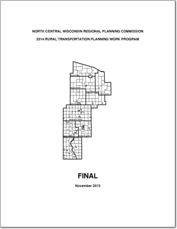
The NCWRPC has been actively involved in transportation planning and received “designation” as a rural transportation planning district from the Wisconsin Department of Transportation.
Oneida County Land and Water Resource Management 2012-2016
The Oneida County Land and Water Resource Management (LWRM) plan was developed to assist the county’s citizens and natural resource agencies with managing and protecting the land and water resources throughout Oneida County.
The goals and objectives in this plan will help resolve local natural resource problems as identified by the Citizens Advisory Committee (CAC). These goals and objectives will also provide the basis for various local, state, and federal agencies to coordinate implementation of their programs of land and water management.
Volk Field Hardwood Range Joint Land Use Study – 2011
A Joint Land Use Study (JLUS) is a collaborative effort between the military, local government, business, property owners, and other stakeholders. Since it was first established as a Military Reservation by the State of Wisconsin in 1888, what is now known as Volk Field has played an important role in state history, the economy of Central Wisconsin, and national security. A grant was approved by the Department of Defense in order to develop a JLUS that would address current and potential future encroachment that may threaten the mission of the Base, and as a way of fostering communication between the military and the community.
Lincoln County Outdoor Recreation Plan 2012-2016
Outdoor Recreation Plan
The primary purpose of this outdoor recreation plan is to provide continued direction toward meeting the current and future recreation needs of Lincoln County, Wisconsin
This Outdoor Recreation Plan (ORP) was prepared pursuant to Wisconsin Statute §23.30 Outdoor Recreation Program. This section serves “to promote, encourage, coordinate, and implement a comprehensive long-range plan to acquire, maintain, and develop for public use, those areas of the state best adapted to the development of a comprehensive system of state and local outdoor recreation facilities and services…”
NCWRPC News Winter 2011 – Issue 46
Forest County Potawatomi Comprehensive Plan – 2011
The Forest County Potawatomi community is a sovereign nation chartered by the Bureau of Indian Affairs, and is recognized federally as a Native American Tribal Nation and operates under a ratified constitution. The tribal lands are scattered within the Town of Lincoln in Forest County, Wisconsin. The Town of Lincoln the is a double township stacked atop each other, less the area taken up by the City of Crandon and two sections from the northeast and southwest corners. The Town lies in the southwest corner of Forest County, Wisconsin and surrounds the City of Crandon on three sides.
Forest County Land and Water Resource Management 2012-2016
The Forest County Land and Water Resource Management (LWRM) plan was developed to assist the county in managing and protecting the land and water resources throughout Forest County.
The goals and objectives in this plan will help resolve local natural resource problems as identified by the Citizens Advisory Committee (CAC). These goals and objectives will also provide the basis for various private, local, state, and federal agencies to coordinate implementation of their programs of land and water management. Additional advice was received from the Forest County Land and Water Committee during the course of meetings and in the form of motions or suggestions for items and issues to include in the plan.
NCWRPC News Fall 2011 – Issue 45
City of Mosinee Downtown Development Plan – 2011
Business growth in downtown Mosinee has been stagnant for many years. However, there has been recent activity as the result of a major transportation improvement project which included a new bridge and a roundabout. In addition, the Wisconsin Department of Transportation conducted a circulation study for Highway 153 through the downtown. That study and its recommendations helped spur more discussion about the downtown. As a result, community leaders identified the need to prepare a downtown development plan.
Vilas County Bicycle and Pedestrian Plan 2011
This plan is intended to guide the development of an interconnected bikeway and pedestrian system for Vilas County, Wisconsin. The Vilas Area Silent Sports Association (VASSA), in conjunction with the local area trail groups around the County, prepared this plan to establish a fresh blueprint for its efforts and the efforts of other agencies and organizations with interest in trails and routes within the County. The trails and routes recommended within the plan will connect people to destinations such as employment centers, schools, residential districts, recreation areas and commercial retail areas (downtowns and surrounding shopping areas). This plan incorporates interconnection with neighboring communities and various destinations outside of the County.