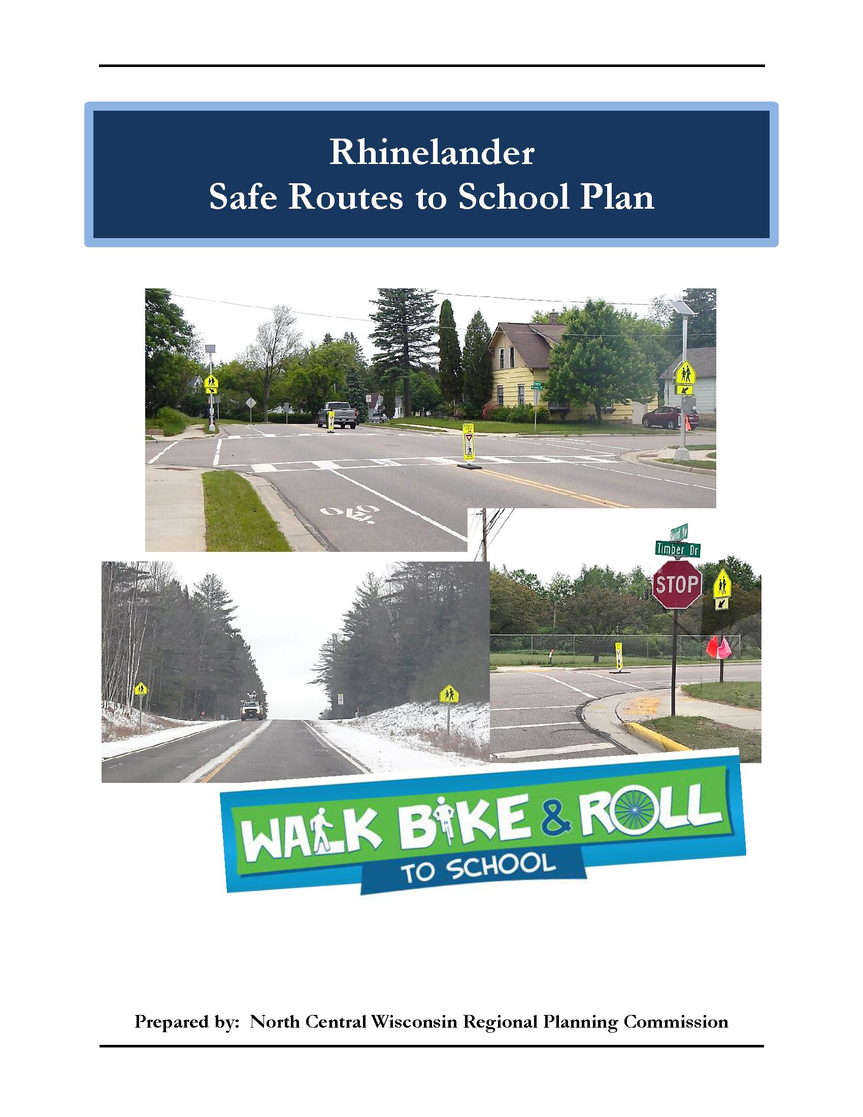
Safe Routes to School (SRTS) programs are an opportunity to make walking and bicycling to school safer for children in grades K-8, and to increase the number of children who choose to walk and bicycle. On a broader level, SRTS programs can enhance children’s health and well-being, ease traffic congestion near the school, and improve community members’ overall quality of life.
Planning Process
In 2022, the North Central Wisconsin Regional Planning Commission and the Wisconsin Rapids School District won a WisDOT SRTS planning grant to create a SRTS Plan for several schools in the District. In the fall of 2023, the City and District began SRTS Planning with the assistance of the North Central Wisconsin Regional Planning Commission (NCWRPC). The NCWRPC guided the Wisconsin Rapids SRTS Task Force through the planning process.
The following schools are part of Wisconsin Rapids SRTS Planning:
Wisconsin Rapids Area Middle School
Grant Elementary
Grove Elementary
Howe Elementary
Mead Elementary
THINK Academy
Washington Elementary
Woodside Elementary
Wisconsin Rapids SRTS Task Force
Ronald Rasmussen, Superintendent, WRPS
Kelly Schaeffer, Wisconsin Rapids Area Middle School Principal, WRPS
Tina Wallner, Grove Elementary Principal, WRPS
Steve Thayer, Howe Elementary Principal, WRPS
Kim Akey, Mead Elementary Principal, WRPS
Rod Watson, Washington Elementary Principal, WRPS
Bill Oswald, Woodside Elementary Principal, WRPS
Edwin Allison, Director of Buildings and Grounds, WRPS
Aaron Nelson, Business Services, WRPS
Officer Dan Pelot, Student Resource Officer, WRPS
Joe Eichsteadt, PE, City Engineer, City of Wisconsin Rapids
Kyle Kearns, Community Development Director, City of Wisconsin Rapids
Kristie Egge, MPH, Supervisor of Strategic Initiatives, Wood County Health Department
Hannah Wendels Scott, FoodWIse Nutrition Educator, Wood County, UW-Madison Extension
THINK Academy
Kevin Whipple, Village of Rudolph President
Christine Slattery, THINK Academy Principal, WRPS
Roland Hawk, Wood County Highway Commissioner
Grant Elementary
Sharon Schwab, Town of Grant Chairperson
Nikki Calteux, Grant Elementary Principal, WRPS
Nathan Check, Portage County Highway Commissioner
Staff
Fred Heider, AICP, Planner, North Central Wisconsin Regional Planning Commission
Make questions or comments about the planning here.
(Email link to submit comments on this plan.)