Langlade County

Langlade County is a county located in northern Wisconsin. As of the 2020 census, the population was 19,491. The county seat is Antigo. Langlade County was created in 1879 and is named after Charles Langlade, a prominent fur trader and early settler in Wisconsin. The county is known for its many lakes, forests and outdoor recreational opportunities, including the Langlade County Forest, the Wolf River and the Ice Age Trail. The county is mostly rural with logging and paper mills as major industries. The county has several small towns and communities, including White Lake, Elcho, and Summit Lake. The county is also known for its hunting, fishing, and snowmobiling.

TitleDate
Langlade County Economic Profile 2024January 22, 2024
Town of Rolling Comprehensive Plan 2023October 10, 2023
Langlade County Economic Profile 2022June 1, 2022
Grow North Region Housing Study – 2021December 29, 2021
Langlade County Outdoor Recreation Plan 2022-2026September 1, 2021
Langlade County All Hazards Mitigation Plan Update 2020July 21, 2020
Elcho Safe Routes to School PlanJuly 1, 2020
White Lake Safe Routes to School PlanJune 1, 2020
Town of Polar Comprehensive Plan 2019October 17, 2019
Town of Antigo Comprehensive Plan 2019September 1, 2019
Langlade County Land and Water Resource Management 2020-2029July 19, 2019
Langlade County Bicycle and Pedestrian Plan 2019May 21, 2019
Langlade County Comprehensive Plan 2019February 10, 2019
Langlade County Scout Camp Concept Plan – 2019January 1, 2019
Langlade County Locally Developed, Coordinated Public Transit-Human Service Transportation Plan 2019-2023August 31, 2018
City of Antigo Comprehensive Plan 2018August 1, 2018
Langlade County Outdoor Recreation Plan 2017-2021December 1, 2016
Village of White Lake Comprehensive Plan 2017September 26, 2016
Langlade County Farmland Preservation Plan 2014December 1, 2014
Langlade County Land and Water Resource Management 2015-2019November 1, 2014
Northwoods NiiJii Enterprise Community, Inc. Comprehensive Strategic Plan – 2014January 1, 2014
Langlade County, Ice Age National Scenic Trail – 2014January 1, 2014
Langlade County All Hazards Mitigation Plan Update 2013October 22, 2013
Langlade County Locally Developed, Coordinated Public Transit-Human Service Transportation Plan 2014-2018July 25, 2013
Langlade County Outdoor Recreation Plan 2012-2016January 1, 2012
Town of Rolling Traffic Count ReportSeptember 10, 2010
Town of Ainsworth Traffic Count ReportJuly 6, 2010
Antigo Safe Routes to School Plan – 2010-2015June 1, 2010

Juneau County

Juneau County is a county located in central Wisconsin. As of the 2020 census, the population was 26,718. The county seat is Mauston. Juneau County was created in 1857 and is named after Solomon Juneau, one of the founders of Milwaukee. The county is known for its rolling hills and valleys, as well as the Lemonweir and Wisconsin rivers. The county is home to the Castle Rock Lake, which is a popular spot for boating and fishing. Agriculture is the main industry in Juneau County, with dairy farming being particularly prevalent. Additionally, the county is home to several small communities and towns, including New Lisbon, Elroy and Necedah.

TitleDate
Village of Necedah Comprehensive Plan 2024March 15, 2024
Juneau County All Hazards Mitigation Plan UpdateMarch 4, 2024
Juneau County Economic Profile 2022January 22, 2024
Juneau County Housing Assessment 2023September 14, 2023
Town of Clearfield Comprehensive Plan 2022August 1, 2022
Juneau County Economic Profile 2024January 1, 2022
Juneau County Outdoor Recreation Plan 2022-2026October 1, 2021
City of Elroy Comprehensive Plan 2021September 14, 2021
Town of Armenia Comprehensive Plan 2021April 14, 2021
City of New Lisbon Comprehensive Plan 2020October 19, 2020
Mauston Safe Routes to School PlanApril 1, 2020
Juneau County Bicycle and Pedestrian Plan 2019April 1, 2019
Human Services Transportation Needs AssessmentMarch 31, 2019
Adams-Juneau Flood Resiliency StudyDecember 1, 2018
Juneau County Locally Developed, Coordinated Public Transit-Human Service Transportation Plan 2019-2023August 20, 2018
Town of Cutler Comprehensive Plan 2018August 1, 2018
Juneau County Housing StudyFebruary 20, 2018
Juneau County All Hazards Mitigation Plan Update 2018January 23, 2018
Town of Lemonweir Comprehensive Plan 2017September 1, 2017
Town of Germantown Comprehensive Plan 2017May 1, 2017
Juneau County Outdoor Recreation Plan 2017-2021February 1, 2017
City of Mauston Outdoor Recreation Plan 2017-2021January 1, 2017
Town of Germantown, Wisconsin Road Surface Management Plan 2017January 1, 2016
Village of Necedah Comprehensive Plan 2015October 1, 2015
Juneau County Locally Developed, Coordinated Public Transit-Human Service Transportation Plan 2014-2018August 22, 2013
Juneau County Outdoor Recreation Plan 2012-2017January 1, 2012
City of Mauston Outdoor Recreation Plan 2012-2016January 1, 2012
Volk Field Hardwood Range Joint Land Use Study – 2011December 1, 2011
Northeast Juneau County Community Wildfire Protection Plan 2010April 1, 2010
City of New Lisbon Comprehensive Plan 2009December 1, 2009
Town of New Plymouth Plan 2009November 1, 2009
City of Elroy Comprehensive Plan 2009November 1, 2009
Town of New Lisbon Comprehensive Plan 2009July 1, 2009

Forest County

Forest County is a county located in northernf Wisconsin. As of the 2020 census, the population was 9,179. The county seat is Crandon. Forest County was created in 1885 and is named after the heavily forested terrain within its borders. The county is known for its many lakes, forests and outdoor recreational opportunities. The Chequamegon-Nicolet National Forest covers a large portion of the county. The county is mostly rural with forestry and tourism being the main industries.

TitleDate
Forest County Comprehensive Plan 2024May 17, 2024
Mole Lake All Hazards Mitigation Plan 2024April 10, 2024
Forest County Economic Profile 2024January 22, 2024
Forest County Economic Profile 2022January 1, 2022
Grow North Region Housing Study – 2021December 29, 2021
Forest County Building MappingDecember 14, 2021
Forest County Hydro MappingDecember 14, 2021
Town of Wabeno Comprehensive Plan 2021October 1, 2021
Forest County Outdoor Recreation Plan 2022-2026October 1, 2021
Forest County Potawatomi Community Bicycle & Pedestrian PlanSeptember 1, 2021
Forest County All Hazards Mitigation Plan Update 2021January 19, 2021
Forest County Parcel MappingJanuary 8, 2021
Town of Lincoln Comprehensive Plan 2020November 1, 2020
Wabeno Safe Routes to School PlanMay 1, 2020
Forest County Locally Developed, Coordinated Public Transit-Human Service Transportation Plan 2019-2023August 31, 2018
Forest County Land and Water Resource Management 2018-2027January 1, 2018
Forest County Land and Water Resource Management 2018-2027September 1, 2017
Town of Hiles Comprehensive Plan – Amended 2017June 29, 2017
Forest County Outdoor Recreation Plan 2017-2021October 1, 2016
Mole Lake All Hazards Mitigation Plan 2016April 1, 2016
Forest County Farmland Preservation Plan 2016March 1, 2016
Forest County All Hazards Mitigation Plan Update 2015November 10, 2015
Forest County All Hazards Mitigation Plan 2015November 10, 2015
Northwoods NiiJii Enterprise Community, Inc. Comprehensive Strategic Plan – 2014January 1, 2014
Feasibility Study for Former School Site Town of ArgonneJanuary 1, 2014
Forest, Oneida, Vilas County Locally Developed, Coordinated Public Transit-Human Service Transportation Plan 2014-2018August 7, 2013
Forest County Motorized Recreational Area – 2013January 1, 2013
City of Crandon All Hazards Mitigation Plan Update 2012November 7, 2012
Forest County Outdoor Recreation Plan 2012-2016January 1, 2012
Forest County Potawatomi Comprehensive Plan – 2011November 1, 2011
Forest County Land and Water Resource Management 2012-2016November 1, 2011
Forest County Comprehensive Plan 2011May 1, 2011
Sokaogon Chippewa Community Comprehensive Plan – 2011May 1, 2011
Town of Laona Comprehensive Plan 2011April 1, 2011
Town of Freedom Comprehensive Plan – 2010July 10, 2010
Town of Alvin Comprehensive Plan – 2010July 1, 2010
Town of Hiles Comprehensive Plan – 2010May 1, 2010
Town of Lincoln Comprehensive Plan – 2010April 12, 2010
Town of Armstrong Creek Comprehensive Plan – 2010April 1, 2010
Town of Argonne Comprehensive Plan – 2010March 1, 2010
Town of Wabeno Comprehensive Plan – 2010March 1, 2010
City of Crandon Comprehensive Plan – 2010January 1, 2010
Town of Blackwell Comprehensive Plan – 2010January 1, 2010
Town of Nashville Comprehensive Plan – 2009September 29, 2009

Economic Development

The NCWRPC provides technical grant writing and administrative assistance to communities that are seeking funds from the U.S. Department of Commerce, Economic Development Administration (EDA). The NCWRPC also provides assistance for a wide variety of other grant programs, including the Wisconsin Department of Commerce (CDBG program), the Wisconsin Department of Natural Resources, and USDA-Rural Development.

NCWRPC annually prepares a Comprehensive Economic Development Strategy (CEDS) that analyzes the regional economy and identifies potential economic development projects. This report maintains the Region’s eligibility for EDA public works programs. Other federal and state programs utilize this plan as well. NCWRPC also prepares EDA grant applications, among others, to bring funding into the Region.

Adams County

Adams County is a county located in central Wisconsin. As of the 2020 census, the population was 20,654. The county seat is Friendship. The county was created in 1848 and is named after the second President of the United States, John Adams. Adams County is known for its rolling hills and scenic views. It is also home to the Big Roche-A-Cri State Park, which features a large rock formation and hiking trails. The county is mostly rural, with agriculture being the main industry.

TitleDate
Adams County Economic Profile 2024January 22, 2024
City of Adams Outdoor Recreation Plan 2024-2028December 29, 2023
Adams County Broadband PlanSeptember 27, 2023
Adams County Outdoor Recreation Plan 2024-2028August 7, 2023
Town of Big Flats Comprehensive Plan 2023July 28, 2023
Town of Quincy Comprehensive Plan 2022March 1, 2022
Town of Easton Comprehensive Plan 2022February 21, 2022
Adams County Economic Profile 2022January 1, 2022
Adams County All Hazards Mitigation Plan Update 2020August 18, 2020
Adams County Strategic PlanOctober 1, 2019
Adams-Friendship Safe Routes to School PlanOctober 1, 2019
City of Adams Outdoor Recreation Plan 2019-2023June 1, 2019
Adams County Comprehensive Plan 2018January 15, 2019
Adams County Outdoor Recreation Plan 2019-2023January 1, 2019
Adams-Juneau Flood Resiliency StudyDecember 1, 2018
Adams County Locally Developed, Coordinated Public Transit-Human Service Transportation Plan 2019-2023August 31, 2018
Town of Adams Comprehensive Plan 2018May 1, 2018
Village of Friendship Comprehensive Plan 2018March 1, 2018
City of Adams Comprehensive Plan 2017September 1, 2017
Town of Richfield Comprehensive Plan 2017August 1, 2017
Town of Jackson Comprehensive Plan 2017April 1, 2017
Town of Preston Comprehensive Plan 2017March 1, 2017
Adams County Farmland Preservation Plan 2016December 1, 2016
Adams County Rural and Industrial Development Commission Economic Development StrategyNovember 17, 2016
Town of Colburn Comprehensive Plan 2016November 1, 2016
Town of New Chester Comprehensive Plan 2016November 1, 2016
Town of Dell Prairie Comprehensive Plan 2016September 1, 2016
Town of Rome Comprehensive Plan 2016May 1, 2016
Adams County Land and Water Resource Management Plan 2010-2015November 1, 2015
Adams County All Hazards Mitigation Plan Update 2015August 1, 2015
2014-2018 Locally Developed, Coordinated Public Transit – Human Services Transportation PlanAugust 22, 2013
Town of Big Flats Comprehensive Plan 2013August 1, 2013
Adams County Bicycle & Pedestrian Plan SummaryMay 1, 2013
Adams County Bicycle & Pedestrian Plan – 2013May 1, 2013
Adams County Outdoor Recreation Plan 2013-2018April 9, 2013
Village of Friendship Traffic Count Report – 2010October 20, 2010
Big Flats/Monroe Community Wildfire Protection Plan 2010July 27, 2010
Adams County All Hazards Mitigation Plan Update 2009August 12, 2009

Comprehensive Economic Development Strategy 2018 Annual Performance Report

An assessment of economic development activities of the North Central Wisconsin Regional Planning Commission over the last decade and the past year. The report’s seven sections describe the CEDS Committee, Past Year’s Activities, the Physical Region, Changes in the Region’s Population, changes in the Region’s Economy, a Regional Development Strategy, and an Economic Development Work Plan. Also included is a list of potential public works projects. This CEDS process maintains the Region’s eligibility as an Economic Development District (EDD) with the U.S. Economic Development Administration. The District consists of ten counties. These counties are Adams, Forest, Juneau, Langlade, Lincoln, Marathon, Oneida, Portage, Vilas, and Wood. However, Portage, and Wood Counties do not fully participate in the EDD – only some local communities with these two Counties participate.

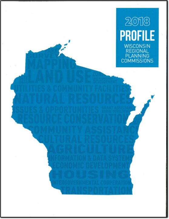
Profile – Wisconsin Regional Planning Commissions

Over the years, the demands on the regional planning commission (RPCs) have changed. These changes, however, have not altered the basic advisory role of the commissions. The original and traditional role of the commissions was to plan for the physical development of the areas they served. This involved planning issues, such as land use, transportation, natural resources, and water and sewer services. While this function has continued to be important, technical assistance in such areas as economic development, grant and loan services, and local government management.

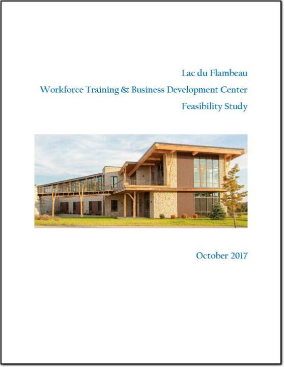
Lac du Flambeau Workforce Training & Business Development Center Feasibility Study

The Lac du Flambeau Tribe of North Central Wisconsin has proposed the establishment of a Workforce Training & Business Development Center (Center). This project has been identified as critical for the long-term economic development growth of both Lac du Flambeau tribal members and area non-tribal members. The Center would be located in the reservation business park.
Specifically, the project aims to:
• Train area unemployed and underemployed for high demand high wage positions, and
• Stimulate new business formation and expansion, and
• Expand the overall economic strength of the area.