Resources – Regional Safe Routes To School


HomePedestrian SafetyBicycle SafetySRTS PSAs

Keep Going! Walk & Bike Year-Round

Here is additional advice on how to sustain enthusiasm from walk-bike events to create year-round walking and biking to school:

Low-cost strategies for successful walk & bike to school rates (CDC, 2014)
Full CDC study

FOR KIDS: NHTSA–Kids Walking Guide

FOR PARENTS (Walking): Nat’l SRTS–Teaching Kids To Walk Safely (by age)

FOR PARENTS (Biking): Portland’s Family Biking Guide (all stages of riding)

Bike Parking Guidelines

NCWRPC Walking/Biking Club Toolkit

Railroad crossing signs for SRTS in Wauwatosa, WI

School Success Story – Omro, WI (2010 population: 3,500)
    – Annual bicycle field trip;
    – bicycle mechanics program; and
    – other successes.

Walking School Buses
Walking school buses are a great way to offer children a supervised walk to school on a regular basis.

Bicycle Trains and Bicycle Skills Clinics
Bicycle trains allow students to bicycle to school together on a designated route under supervision. Bicycle Skills Clinics or “bicycle rodeos” are hands-on bicycle safety lesson with bike inspections, safety talks and bicycle skills practice.

Youth Education – available for a nominal fee [Wisconsin Bike Fed].

Adult Education – available for a nominal fee [Wisconsin Bike Fed].

Mileage Tracking
Providing a way for students to track the miles that they have walked or ridden a bicycle is a tangible way to chart progress toward a walking or biking goal.


Links to SRTS surveys:
 
Class Tally Sheet
 
Parent Survey (English)
Parent Survey (Español)
Parent Survey (Hmoob)

Marathon County Locally Developed, Coordinated Public Transit-Human Service Transportation Plan 2024-2028

Federal transit law requires that any projects selected for funding under the Section 5310 Enhanced Mobility of Seniors and Individuals with Disabilities (formerly titled Elderly and Disabled Capital Assistance Program) must be derived from a “locally developed, coordinated public transit-human services transportation plan”. This requirement was implemented as part of the SAFETEA-LU legislation and the requirement continues under the new transportation legislation, FAST Act (Fixing America’s Surface Transportation). The purpose of the coordinated planning process is to have stakeholder involvement in the assessment of elderly and disabled transportation, and to provide strategies and goals to improve those transportation alternatives. These coordinated plans were last completed in 2019 and are due to be updated for 2023.

Wood County Bicycle and Pedestrian Plan 2023

The Wood County Ad Hoc Bike & Pedestrian Committee is overseeing the development of the Wood County Bike & Pedestrian Plan.

See below for historical plan and meeting information:

1995 Wood County Bike & Pedestrian Plan

Draft Plan Maps
Map 1—Existing Facilities
Map 2—ATV Routes & Trails
Map 3—Snowmobile Trails
Map 4—Traffic Counts
Map 5—Bike Suitability
Map 6—Functional Classification
Map 7—Crash Data

Interactive Map

Please identify important routes, propose new routes, locate areas of concerns, and show us destinations which you like to walk or bike to.
Interactive Map

The development of the Wood County Bicycle & Pedestrian Plan will involve many people including an advisory group. This bicycle planning document is intended to help local governments, non-profits, businesses, and individuals improve walking and bicycling within Wood County.

The Wisconsin Department of Transportation (WisDOT) encourages planning for bicyclists at the local level. Guidelines for accommodating travel by bicycles when roadways are reconstructed, or new roads are built, are available and their use is encouraged by WisDOT. When this plan is adopted, then road improvement grants (up to 80% state funds & 20% local funds) become available for local governments to competitively apply for.

The Wood County Bicycle & Pedestrian Plan includes:

An inventory of bicycling conditions and sidewalks, bicycle and pedestrian crashes with vehicles, and bicycle and pedestrian use areas. Researching where crashes occurred will show where some problem areas exist. Other problem locations will be found through analysis of the bicycling conditions on each major road.

Locations of potential bicycle routes and recommendations for roadway improvements. Maps will show where people are riding and where they plan to ride when it is safer to do so. Recommendation may include bicycle lanes in high traffic areas, and possibly no change along roads used more by bicyclists than vehicles (e.g. low volume roads).

Recommend solutions. The plan will include a combination of education, encouragement, engineering, and enforcement strategies to increase walking and biking.

Public Service Announcements – Regional Safe Routes To School

HomePedestrian SafetyResourcesBicycle Safety

Safe Routes To School (SRTS) advocacy video that briefly describes what this program is all about. Created by East Central Florida Regional Planning Council with a SRTS grant.
32 second PSA “A”
32 second PSA “B”

.

3.57 minute video
The League of American Cyclists promotes Safe Routes to School programs. Share this video with your local school board, PTA, or city council.

1:23 minute PSA
A PSA from the National Safety Council and First Student featuring safety tips to share the road with school buses. Visit nsc.org/back2school for more information and downloadable materials on back to school safety issues.

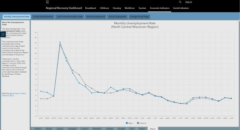
North Central Wisconsin Regional Recovery Dashboard

In response to the COVID-19 pandemic, the NCWRPC was awarded a grant from the Economic Development Administration (EDA) to assist with the economic recovery of the Region. Part of the scope of work for the grant included the development of a Regional Recovery Plan. The Regional Recovery Plan includes both short-term and long-term strategies intended to guide the Region’s economic stabilization and recovery from current and future economic shocks and to help foster a resilient and sustainable North Central Wisconsin.

As the Region continues to recover from the pandemic and build towards a more prosperous future, local communities and organizations can use the North Central Wisconsin Regional Recovery Dashboard to help track the Region’s progress on issues that were identified in the Regional Recovery Plan as crucial to the prosperity of North Central Wisconsin.

Marathon County Highway Study

This Marathon County 2050 Highway System Sustainability Study is a planning tool subject to budget appropriation in each County budgeting cycle. Actual revenues and expenditures must be approved by the Marathon County Board in its annual budget.

This study contains the following elements:

  • An inventory of all county highways including condition, traffic levels, crashes and other relevant factors.
  • An analysis of growth and development information to help determine highway service priorities.
  • An analysis of potential future changes to the County Highway System due to anticipated growth or other factors.
  • An assessment of necessary maintenance with anticipated expenses accounting for inflation over time. maintenance, including crack filling, chip sealing, resurfacing, reconstruction, etc.
  • A breakdown of recommended average funding needed to adequately maintain existing roadways